GeoDroPh
Georeferenced drone photographs
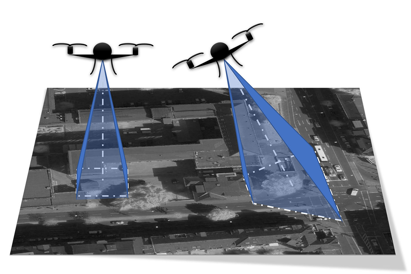
Drone pilots in the field face the challenge of having to quickly assess whether a drone flight was successful or not. In the worst case, this only becomes apparent during the labor-intensive process of generating an orthophoto using the standard photogrammetric workflow. Depending on the dataset, this process can take hours or even days. If in doubt, an aerial survey campaign may have to be repeated at considerable effort. In other situations, there is a need to evaluate individual aspects in the field in connection with other geodata, which is currently not possible without the standard photogrammetric procedure, as the images lack correct georeferencing. This is because drone images are often JPG or TIFF files with only a single coordinate at the image center and no image orientation.
Project objectives
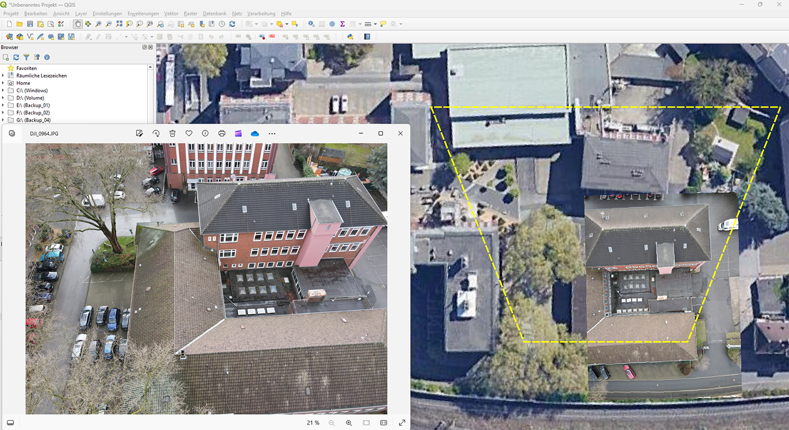
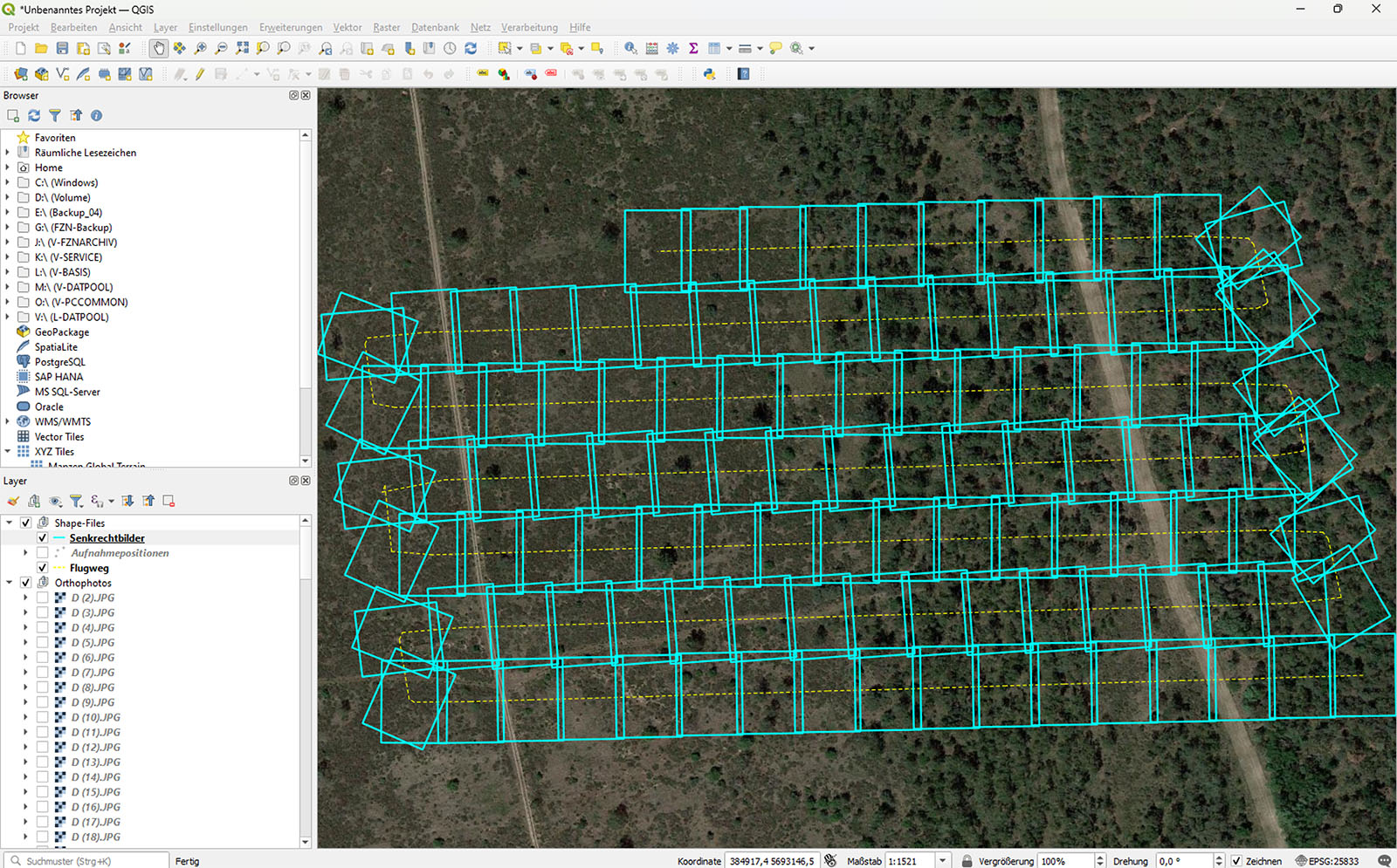
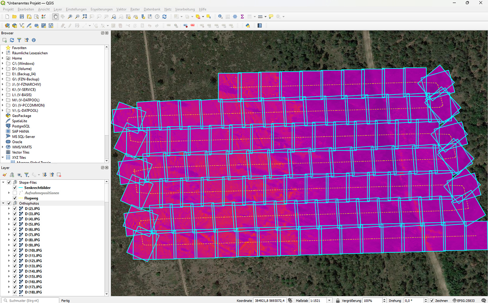
GeoDroph creates a plug-in for the open-source software QGIS that is capable of placing individual images in their correct spatial position within the GIS software QGIS while bypassing the standard photogrammetric workflow. The aim is to enable a rapid assessment of the success of an aerial survey campaign. This fast georeferencing also supports on-site situation assessment in emergency scenarios, for example during operations by authorities and organizations with security responsibilities, without the long waiting times associated with generating an orthophoto (image composite).
Methodology
In essence, all information contained in the so-called EXIF data of the JPG and TIFF files is used. During image acquisition, the drone software stores useful information there. This includes, for example, the altitude above the take-off point (image scale), data from the inertial measurement unit (IMU; roll, pitch, yaw for the spatial orientation of the image), the magnetic compass (additional information on cardinal direction), and camera parameters such as exposure and focal length. These data are read out and correctly assigned to the image so that it can be placed in the GIS at the correct scale and with the correct orientation.


Project duration
01.04.2026 – 30.09.2026
Project funding

The development of the plug-in is funded through the transnational project Interreg NWE – FlashFloodBreaker, which aims to make regions more resilient to increasingly extreme flash flood events. Led by Emschergenossenschaft as the lead partner, water authorities, regional authorities/crisis centers, fire brigades, and research institutes from universities in six Northwestern European countries are working together on the project.
More information:
- Emschergenossenschaft and Lippeverband (EGLV)
- FlashFloodBreaker: Make North-West Europe resilient against increasing extreme flash flood events
- Drohnen als Mittel zur Lagedarstellung (Teil 1) – Eine Bewertung von Nutzbarkeit, Qualität und Geschwindigkeit des Drohneneinsatzes.
– in: FEUERWEHReinsatz:nrw - Drohnen als Mittel zur Lagedarstellung (Teil 2) – Integration von Befliegungsergebnissen unter erschwerten Bedingungen.
– in: FEUERWEHReinsatz:nrw
Contact

Dr. rer. nat. Bodo Bernsdorf
Technische Hochschule Georg Agricola University
Herner Street 45
44787 Bochum
Building 2, Room 102
Phone 0234 968 4210
Mail bodo.bernsdorf@thga.de