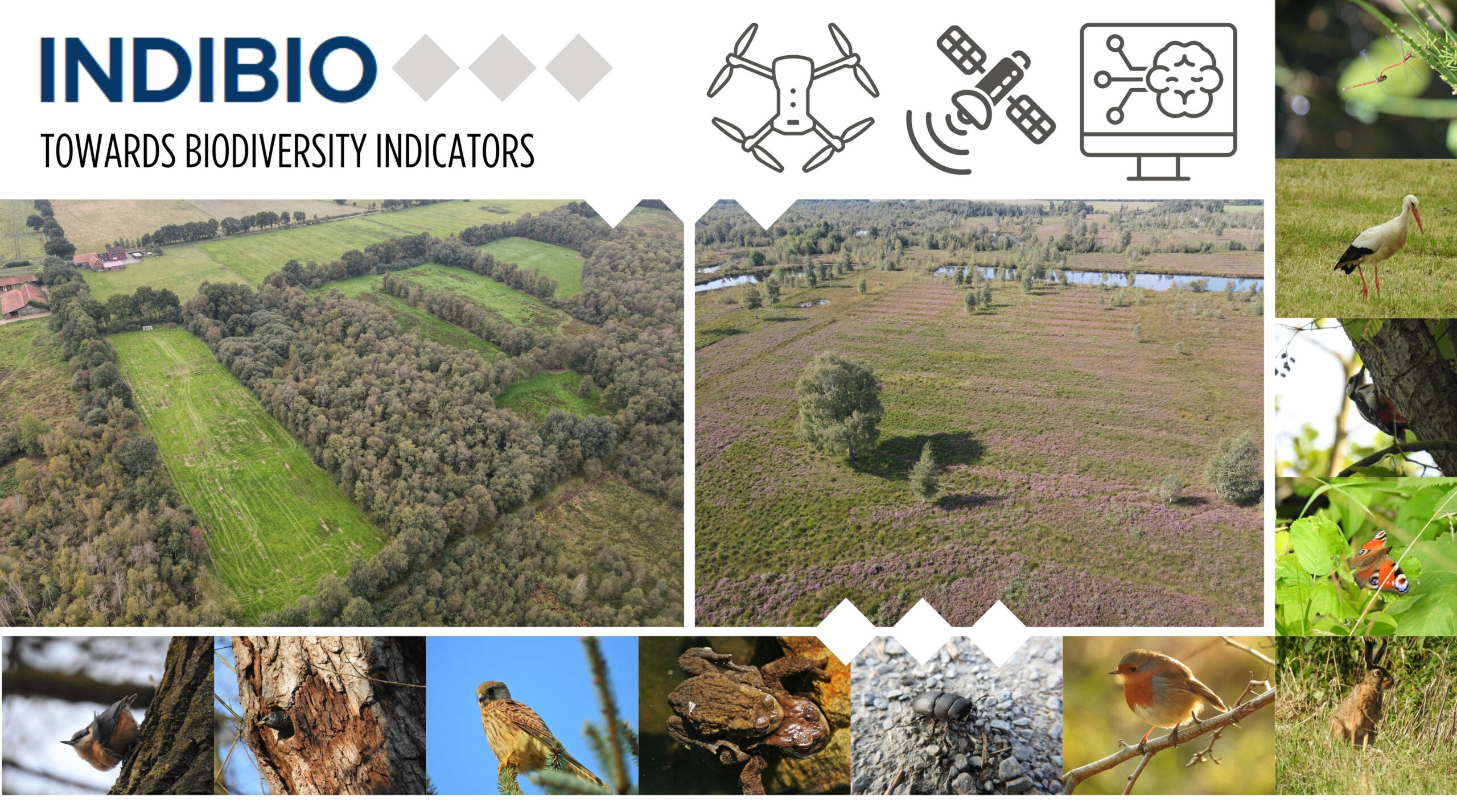
INDIBIO – Development of an indicator for biodiversity in landscapes influenced by industry
Biodiversität bezeichnet die Vielfalt des Lebens auf genetischer, artbezogener, ökosystemarer und funktionaler Ebene. Sie ist Grundlage stabiler Ökosysteme und damit entscheidend für Leistungen wie Bodenfruchtbarkeit, Wasserhaushalt, Klimaregulation und Lebensraumqualität. Der weltweite Verlust biologischer Vielfalt führt unter anderem zu einer Verringerung dieser Ökosystemleistungen und erhöht die Anfälligkeit von Landschaften gegenüber Störungen.
Industrial sites interact closely with their environment. They can have a negative impact on habitats, but they can also generate positive effects through recultivation, renaturation, and targeted land management. However, there is currently a lack of objective, comparable, and practicable metrics for systematically recording and evaluating biodiversity in such contexts.
Project objective
What impact does industry have on the surrounding biodiversity? And how can this impact actually be measured and tracked over time?
This is precisely where the INDIBIO research project comes in. The aim is to develop a scientifically valid, dynamic key performance indicator (KPI) for assessing biodiversity in industrial landscapes. The indicator should make it possible to measure ecological changes, track developments over time, and transparently assess the impact of construction, operation, and recultivation measures.
Photos: Christian Teichmann / Drone photos: Benjamin Haske
Project duration
November 1, 2025 – October 31, 2028
Project approach
The project combines existing methods—such as species counts, biotope mapping, and habitat assessments—with innovative remote sensing techniques. Satellite and drone data, terrain surveys, and site-specific parameters are brought together in an integrated approach and tested for operational applicability. This results in an area-wide monitoring procedure that reveals changes over time and documents the effects of measures in a comprehensible manner.
Pilot site
The methodology will initially be tested at a large cavern storage site in Gronau-Epe in collaboration with Uniper Energy Storage. The area is particularly interesting from a geological and ecological perspective: salt has been mined there for around five decades, and the caverns created are now used for gas storage. The Amtsvenn-Hündfelder Moor nature reserve is located in the immediate vicinity, creating an exciting transition between industrial and natural areas.
The location thus offers ideal conditions for developing and validating the KPI under real-world conditions. The extensive data and experience gained from previous projects make this location an ideal candidate for the project study. Subsequently, the KPI will be transferred to other industrial sites.
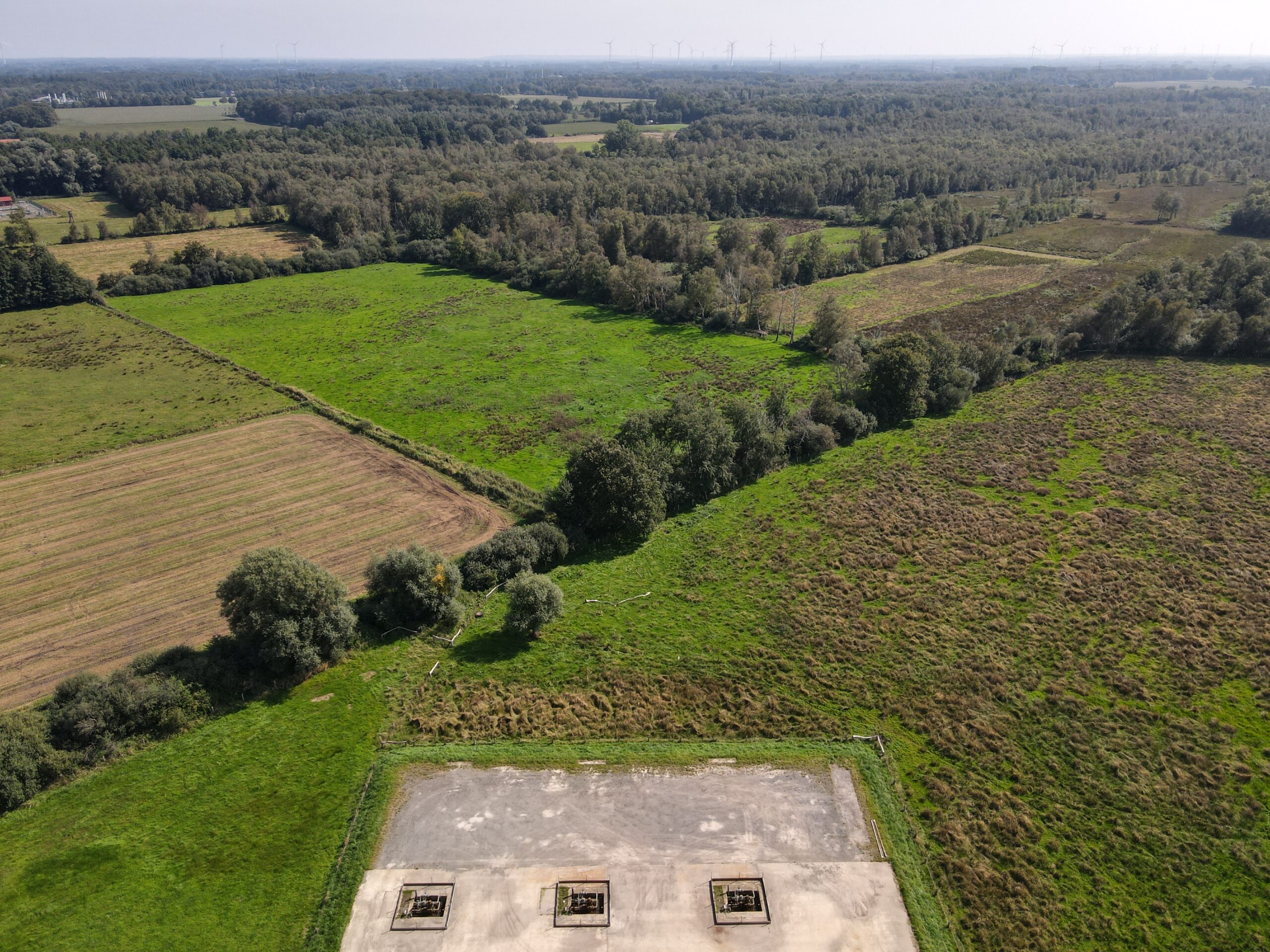
Photo: Benjamin Haske / FZN
Main areas of work
- Integration of digital data sources: Combination of satellite images, drone footage, and terrain mapping in a semi-automated process that can be used anywhere.
- Selection and weighting of relevant parameters: Examination of ecological indicators for measurability, reproducibility, and significance.
- Development of a biodiversity dashboard: visualization of results as indices and time series, as well as transparent presentation of the impact of measures.
- Transferability and scaling: Further development of the methodology for other industrial contexts.
Expected results and benefits
INDIBIO provides a methodological assessment framework for the objective recording of ecological services in the vicinity of industrial sites. In the long term, the project will contribute to the greater integration of biodiversity protection into industrial decision-making processes.
Project funding
The research project is funded as part of a research collaboration by Uniper Energy Storage GmbH (UST). The project will run for three years (11/2025 – 10/2028).
Contact

Malin Chrzon, M.Sc.
Technische Hochschule Georg Agricola University
Herner Street 45
44787 Bochum
Building 2, Room 008
Phone 0234 968 3815
Mail malin.chrzon@thga.de

Dr.-Ing. Benjamin Haske
Technische Hochschule Georg Agricola University
Herner Street 45
44787 Bochum
Building 2, Room 102
Phone 0234 968 3667
Mail benjamin.haske@thga.de
Prof. Dr. Tobias Rudolph
Technische Hochschule Georg Agricola University
Herner Street 45
44787 Bochum
Building 2, Room 101
Phone 0234 968 3682
Mail tobias.rudolph@thga.de