KaMonSys: Monitoring system for cavern storage
Tailored monitoring for energy transition with modern copter technology and satellite remote-sensing data
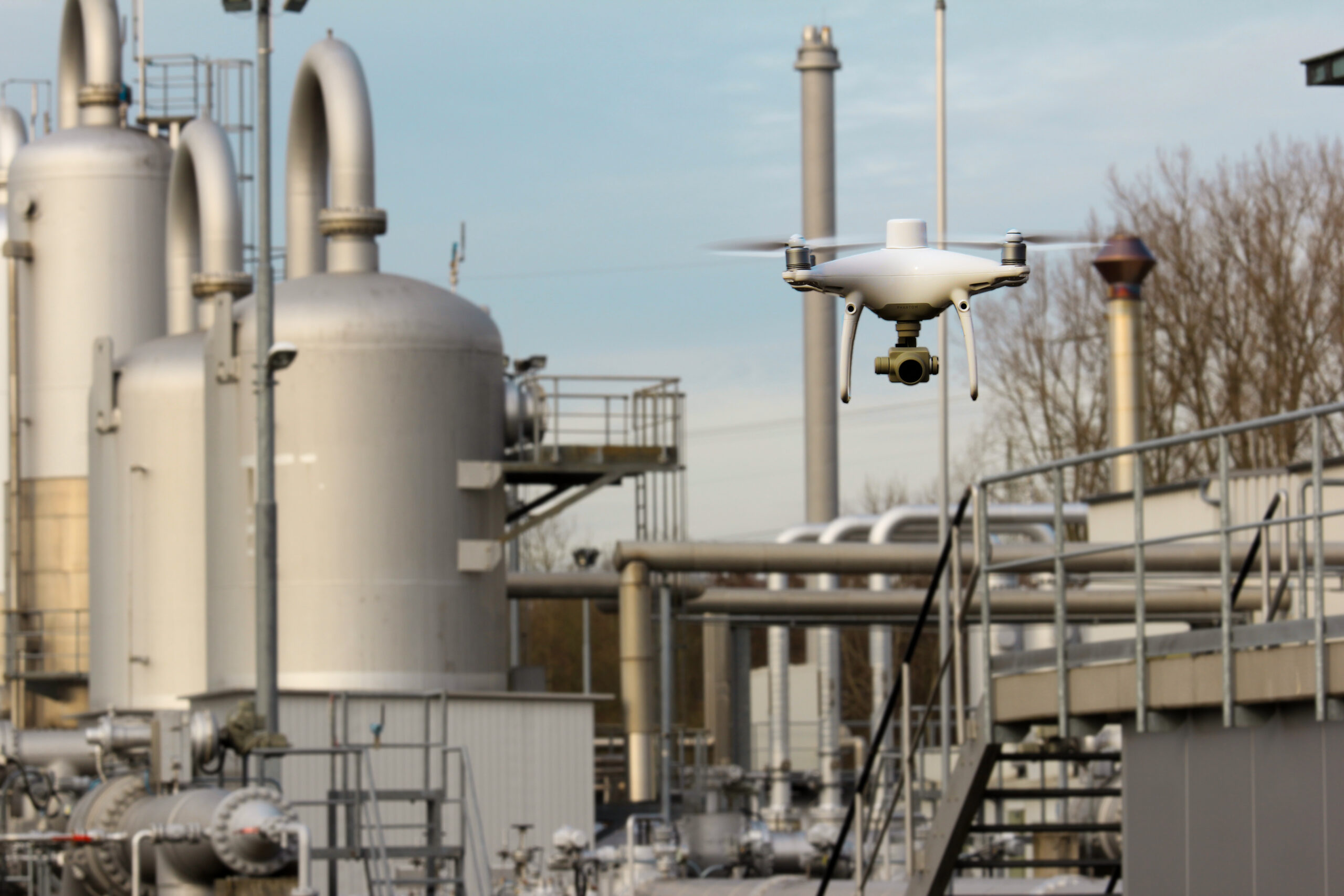
"KaMonSys" is the short form of: "Monitoring system for the safety of cavern storage facilities using satellite and unmanned aerial vehicle (UAV) data)". In this project the Research Center of Post-Mining develops integrated solutions in the area of security for critical infrastructures. The aim is to improve the security of supply of underground natural gas reserves in time of the energy transition and to identify any damage at an early stage. In an interdisciplinary approach, the experts combine classic, technical-geoscientific methods with innovative approaches from remote sensing. Here, copter and satellite-based sensors are used. The data are evaluated integrally for the first time. This innovative combination of methods aims primarily to detect leaks early and reliably to prevent unwanted emissions from escaping.
© Stefanie Krause/THGA
In the project period of two years, the scientists from the Research Center are developing a monitoring system to control the integrity of cavern storage facilities. To this end, the Research Center works closely with EFTAS Another associated partner is the Gas- und Wärmeinstitut Essen e.V.The test sites are provided by the two project partners: the Salzgewinnungsgesellschaft Westfalen mbH in Ahaus and also the Uniper Energy Storage GmbH.
In addition to the constant monitoring of the technical systems and the geological subsurface parameters, the new measurement method also evaluates satellite remote sensing data. By suspicion of a methane/natural gas leaks, a flying copter drone is deployed, which checks the areas or the object and localizes possible leaks spatially. The drone is equipped with highly specialized thermal imaging cameras, which can precisely detect escaping methane using thermal aerial images that make characteristic temperature differences visible, and thus quickly localize possible leaks.
The application is initially aimed at underground gas storage operators. But with little adjustment effort the results can also transferred to many other areas (Refineries, pipeline and transport systems).
One of the used drones is kindly provided by the the start-up initiative of the THGA, StartING@THGA.
The project is funded by the Federal Ministry of Education and Research in the framework program "Research for Civil Security" from September 2020 to August 2022 with 240,000 Euros.
Project objectives
- Linking geospatial analyzes with modern and partially automated remote sensing methods and operational information of the location to detect smallest gas leaks
- Integrated, supplementary safety monitoring to increase the integrity of cavern storage facilities and reduce methane emissions
Partners

Contact

Prof. Dr. Tobias Rudolph
Technische Hochschule Georg Agricola University
Herner Street 45
44787 Bochum
Building 2, Room 101
Phone 0234 968 3682
Mail tobias.rudolph@thga.de

Dr. Bodo Bernsdorf
Technische Hochschule Georg Agricola University
Herner Street 45
44787 Bochum
Building 2, room 106
Phone 0234 968 4210
Mail bodo.bernsdorf@thga.de

Dipl.-Ing. Benjamin Haske
Technische Hochschule Georg Agricola University
Herner Street 45
44787 Bochum
Building 2, room 207
Phone 0234 968 3667
Mail benjamin.haske@thga.de