MuSE: Multi-sensor geospatial monitoring for an optimized post-mining watermanagement
Monitor polder areas and make them sustainableto ensure a sustainable rehabilitation
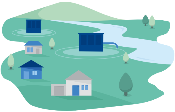
Intensive subsurface mining activities have caused subsidence of the day surface, creating the formation of large depressions – called “polder areas”. In areas such are these, sometimes not all of the waterways can still flow freely. The deeper-lying areas therefore have to be continuously drained to prevent the accumulation of water in rivers and lakes.
These subsidences also change the soil moisture in the region and influence the land use and resources for agriculture, forestry and water management. This has far-reaching consequences – also because of climate change. Particularly under the impression of periods of drought, the question of a modified management of polder water retention arises. For example, higher groundwater levels and the economic and technical use of elevated groundwater and surface water could minimize drought damage in agriculture and forestry.
In the "MuSE" project, scientists from the FZN Research Center of Post-Mining are analyzing what an efficient and sustainable realignment of polder management for better ecosystem servicescould look like. To achieve this, they are evaluating all available historical, current, and modern eEarth observation datasets. They utilize multisensormulti-sensor y measurement systemsdata, which they simultaneously fuse and digitalizeintegrate in a 4D model, with "time" as the fourth dimension.
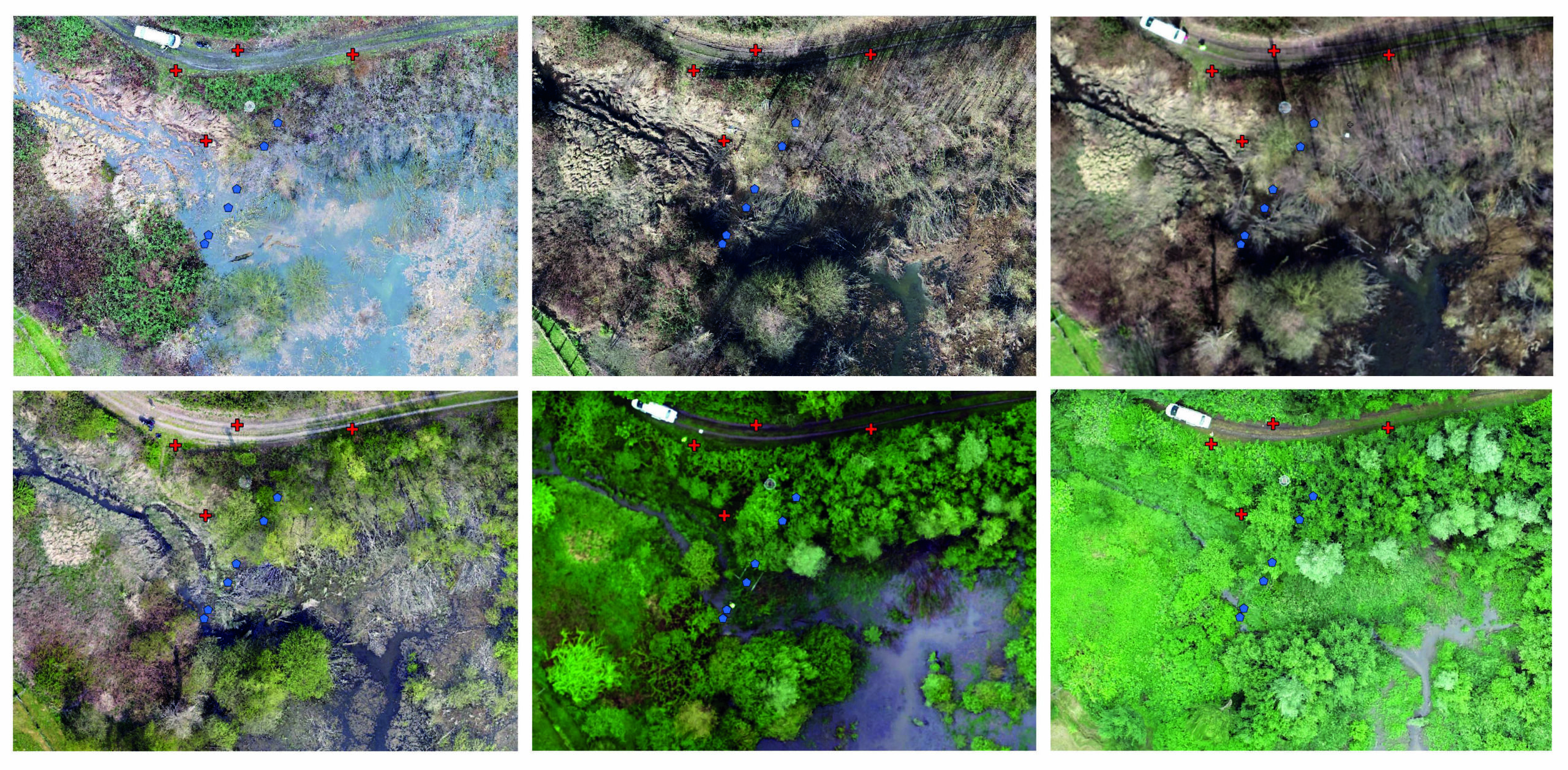
The water flow of the rivers and landscape developmentin these degraded regions can be well traced over time. These mMulti-temporal drone images show a nature reserve at the river Boye in vicinity of the city of Bottrop. The blue dots mark the ground sensors, and red markings serve as reference points for aerial imaging. (© THGA)
The RAG-Stiftung is funding the research project in the period from 2021-2024.
Project objectives
- Development of an integrated geospatial and environmental monitoring with the combination of remote sensing data and multi-sensor measurements on sitedata for nature-based solutions
- Time series analysis of the environmental interactions
- Recommendations on long-term land use as a restoration continuumand resource use for agriculture, forestry and water management
Contact
Prof. Dr. Tobias Rudolph
Technische Hochschule Georg Agricola University
Herner Street 45
44787 Bochum
Building 2, Room 101
Phone 0234 968 3682
Mail tobias.rudolph@thga.de
Dr.-Ing. Marcin Pawlik
Technische Hochschule Georg Agricola University
Herner Street 45
44787 Bochum
Building 2, room 106
Mail marcin.pawlik@thga.de

Dr. Bodo Bernsdorf
Technische Hochschule Georg Agricola University
Herner Street 45
44787 Bochum
Building 2, room 106
Phone 0234 968 4210
Mail bodo.bernsdorf@thga.de

Prof. Dr. Peter Goerke-Mallet
Technische Hochschule Georg Agricola University
Herner Street 45
44787 Bochum
Building 2, room 106
Phone 0234 968 3289
Mail peter.goerke-mallet@thga.de