REWE: Radar remote sensing Epe W-E movement
Integrated geospatial monitoring of the Epe gas cavern storage facility
Decades of intensive salt mining have created large cavities, known as caverns, at depths of 1,000 to 1,500 meters underground around Gronau and Epe. Most of these cavities are now used to store natural gas, which is a major economic factor for the region. However, underground operations can lead to changes on the surface, for example in the form of ground movements. This is why comprehensive geospatial and environmental monitoring of the region is necessary. This is the aim of the “Radar Remote Sensing Epe W-E Movement” (REWE) project, a research collaboration between the Research Center of Post-Mining, Uniper Energy Storage and the EFTAS.GeoIT..
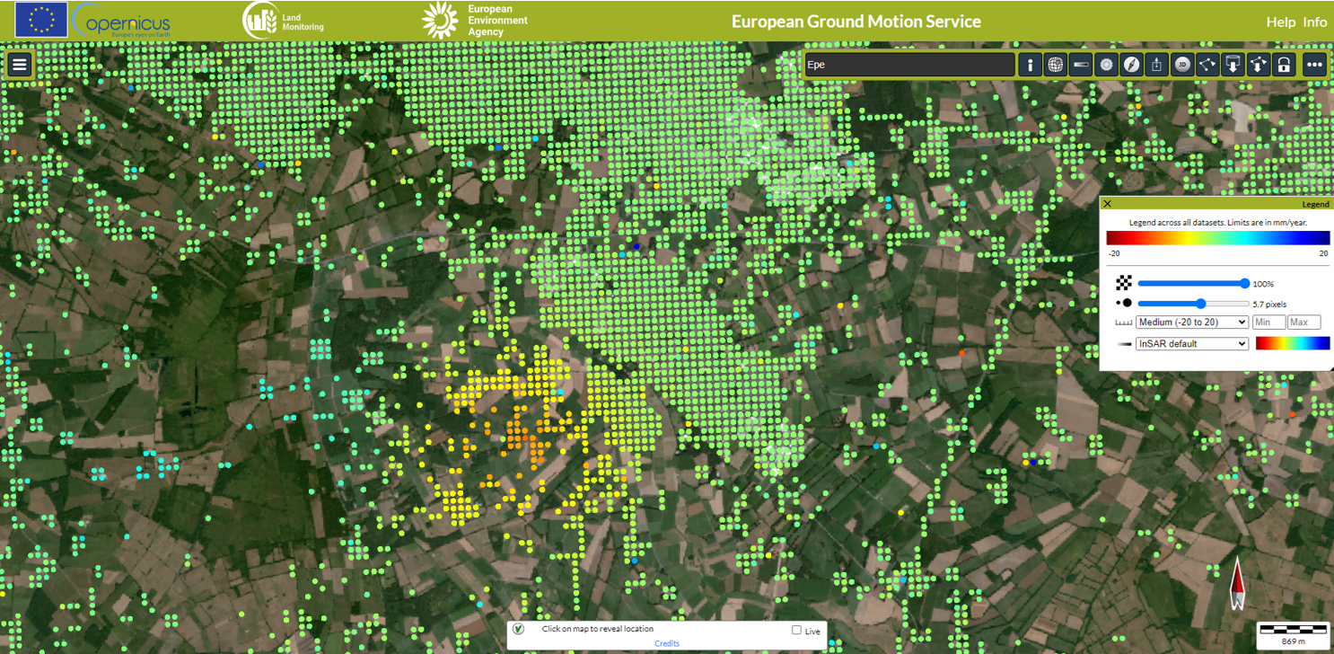
Radar remote sensing enables horizontal ground movements to be detected and measured with millimeter precision using data from the Sentinel-1 satellite. © European Ground Motion Service
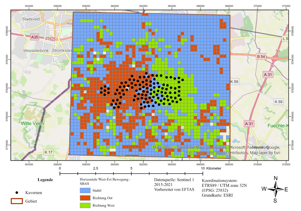
Clustering analysis in the study area reveals patterns of horizontal ground movement in an east-west direction. This allows the influence of the caverns on the surrounding area to be observed. The black dots on the map mark the underground caverns that were driven into Permian Zechstein salt. Based on data from Sentinel 1 (2015-2021). Source of the base map: OpenStreetMap.
In order to obtain a holistic picture of the subsurface movements in the cavern field in Epe, the researchers are combining different monitoring methods: open geodata, data from radar remote sensing and operational data from the cavern field. The combination of these data will enable a detailed analysis of not only vertical but also horizontal ground movements in an east-west direction for the first time.
Project objectives
- Fusion of different geodata from the Epe cavern site
- Analysis of horizontal and vertical ground movements
- Use of AI for an assessment of site integrity
Project funding
Contact

Prof. Dr. Tobias Rudolph
Technische Hochschule Georg Agricola University
Herner Street 45
44787 Bochum
Building 2, Room 101
Phone 0234 968 3682
Mail tobias.rudolph@thga.de
Dr.-Ing. Marcin Pawlik
Technische Hochschule Georg Agricola University
Herner Street 45
44787 Bochum
Building 2, room 106
Phone 0234 968 3805
Mail marcin.pawlik@thga.de