Our underground is in motion. Nevertheless the vibrations are usually so small and spatially limited that they can only be detected by very sensitive sensors. Even in places where mining took place and humans intervened in the natural geology and deposit, micro-seismic events can occur as a result of such activities. Paloma Primo, scientist at the Post-Mining Research Centre (FZN) of the THGA, is tracking down these mini-movements. In the new research project, “PostMinQuake”, the expert examines how they occur, identifies particularly endangered infrastructures and develops a long-term risk management for the affected regions. The native Spanish, who has a master degree as a mining engineer, works closely with other European partners to handle the post-mining era responsively also in Czech Republic, Poland and France.
“Our joint project is as complex as the interrelationships underground,” says Paloma Primo. “Our investigations go far beyond the simple connections between seismicity and geological activities in the partially water-filled, disused coal mines”. That is why experts from different disciplines, such as surveyors, geological engineers and hydrogeologists, work together in this project. Together, they observe the geological dynamic in the respective test sites that have been changed by coal mining – in Germany these mainly are the Ruhr Area, Ibbenbüren and Aachen districts. “In these areas, we document underground micro-seismic activities once a week. We also analyse and link records from past events”. Paloma Primo collects the data from the Geological Survey NRW, RAG AG, Federal Institute for Geosciences and Raw Materials and from seismological stations at the Ruhr University Bochum. “Through these stations, time, size, location and depth of the event are determined”.

In digital exchange with the EU partners: Paloma Primo investigates micro-seismic events in former mining areas in the Reserch Center of Post-Mining. (Photo: THGA/Volker Wiciok)
The experts pursue an important, common issue, explains the 28-year-old researcher: “Through our investigations, we want above all to ensure long-term security, create transparency and inform the public, since every community and former mine operator should have precise knowledge of the processes that take place underground. When it comes to ground movements, there are many fears and misunderstandings about what micro-seismic events are and their effects.” Therefore, the main goal of the project is to understand the mechanisms of micro-seismic events after mining better and to develop plans for long-term monitoring of the earth during mine closure.
Which external influences cause the micro-seismic events? Which parameters can be used to realistically simulate the effects on the PC? And how can satellite images help to correctly interpret the data obtained from the underground? “We are talking about a great amount of data that we first have to standardize in order to make it comparable and then to evaluate using the latest methods” says Primo. Over the next three years, the project team researches to develop a reference database for European areas after mining. In addition, the investigations should help to develop new monitoring strategies and interpretation methods for areas with increased seismic risk. The project is part of the EU-funded Research Fund Coal and Steel (RFCS).
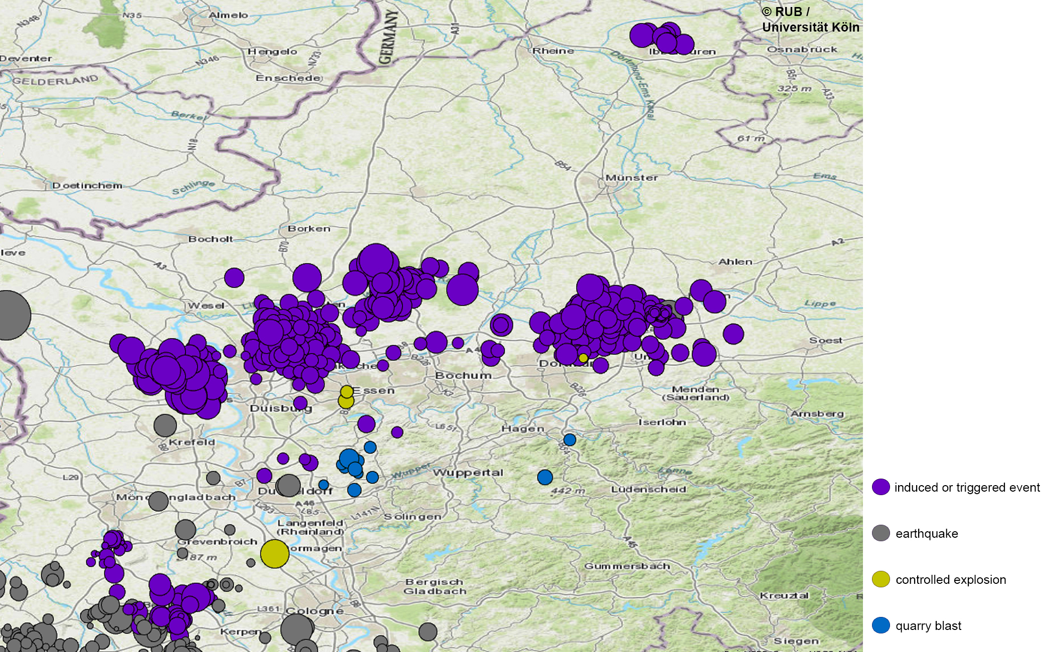
Big data from the underground: In the PostMinQuake project, the researchers classify geographic information from the Geological Survey NRW, RAG AG, Federal Institute for Geosciences and Raw Materials and from seismological stations at the Ruhr University Bochum. Shown here: micro-seismic events in the Ruhr Area between 2010 and 2020. (Map: RUB/University Cologne).
Contact
Paloma Primo, M.Sc.
Technische Hochschule
Georg Agricola University
Herner Straße 45
44787 Bochum
Building 2, room 205
Mail paloma.primo@thga.de


