The FZN is investigating the underground and the effects of mining on the U35 campus line on behalf of the city of Bochum. The new research project is called “NAMIB.”
The CampusLine U35 connects the cities of Bochum and Herne under ground since 1989. In Bochum, it runs from the city limits of Herne in the north through the city center to Ruhr University and ends in the south at Hustadt station. Outside of the pandemic, it is the most successful local transport system in Bochum, with over 90,000 passengers daily. With a very frequent schedule, it runs quickly, reliably, and safely.
To ensure that this remains the case in the long term, a new research project focusing on the U35 has now been launched: on behalf of the city of Bochum and in close cooperation with BOGESTRA, the Georg Agricola Technical University (THGA) is investigating the impact of mining on the U35 campus line. “The trigger for us was the statement by Ruhrkohle AG that it would allow the mine water to rise, which is understandable given the perpetual costs,” explains Karl-Heinz-Reikat, who heads the light rail construction and structural engineering department of the municipal civil engineering office. “This decision by Ruhrkohle AG has an impact on our building ground of our underground railway structures. Therefore we want to have this scientifically investigated and monitored.”
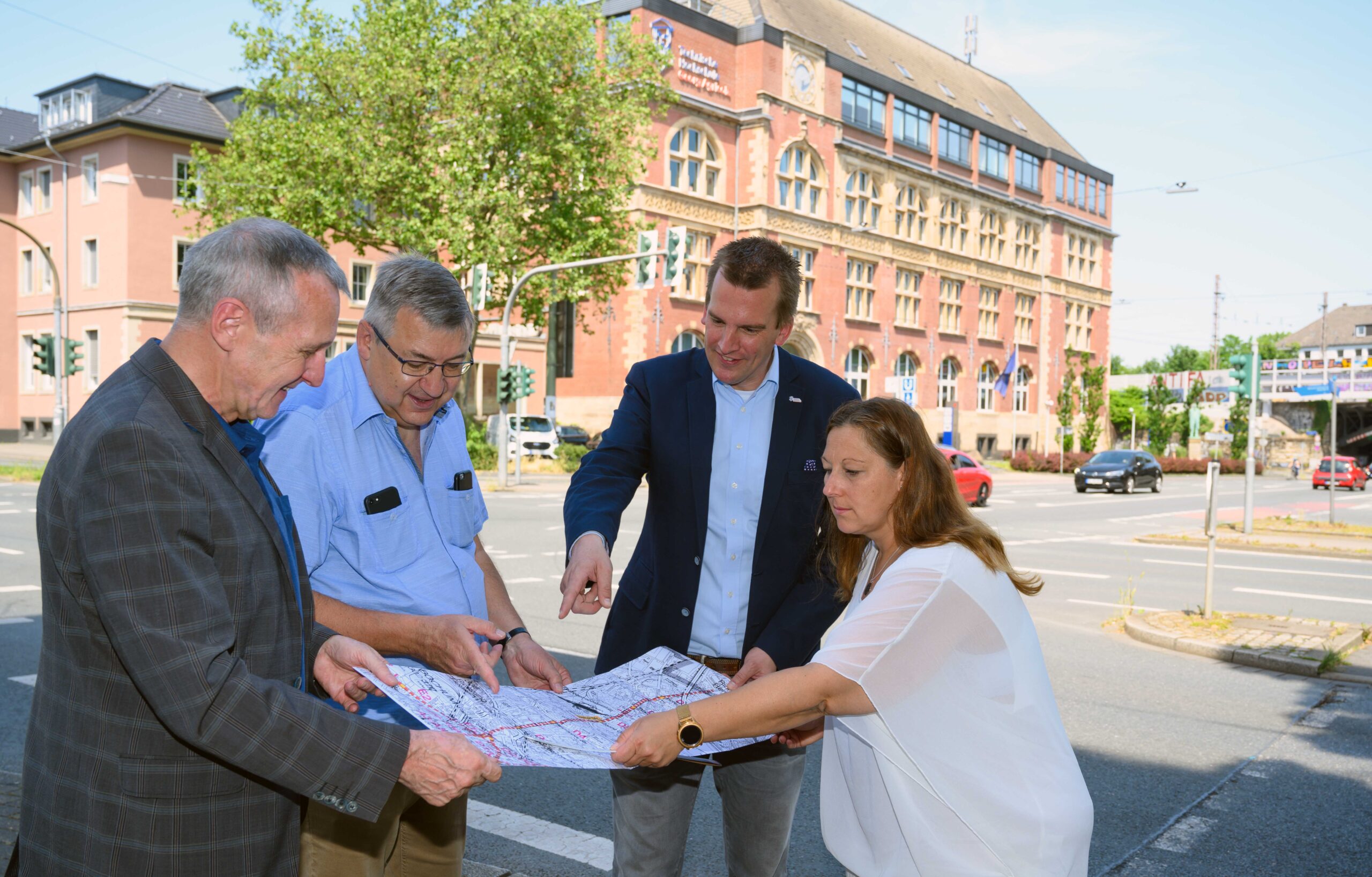
the FZN is investigating the mining influences on the infrastructure of the U35 light rail line (from left to right): Prof. Dr. Peter Goerke-Mallet, Karl-Heinz Reikat, Prof. Dr. Tobias Rudolph, and Rebekka Biermann. (© André Grabowski, City of Bochum)
“Every city should know its underground terrain precisely, says geologist Prof. Dr. Tobias Rudolph from the THGA. Together with his colleagues from the Research Center of Post-Mining, he is therefore investigating the structures beneath our feet. The experts are primarily concerned with the effects left behind by intensive mining. In the subsurface between Bochum and Herne, they want to prove that the subway line remains safe and reliable. The latest digital monitoring methods and modern technology are helping them do this—but so is meticulous archival work. Subway construction meets post-mining.
The project name “NAMIB” is more reminiscent of the African desert than a subway tunnel as a research area – but the acronym stands for “Post-mining and Old Mining Monitoring of Infrastructure in the City of Bochum” ("Nach- und Altbergbau-Monitoring von Infrastruktur der Stadt Bochum“). It's still a bit of a safari, though: for the first time, researchers are evaluating historical and modern data sets in combination. This also includes regular documentation underground, explains Prof. Rudolph: “In order to view the processes holistically and thus be able to prove the integrity of the U35, we naturally have to go down there. If we detect potential risk elements in the process, we transfer them to a classification system.” Possible hazards arise, for example, from geological layer boundaries or old mining structures. “However, it is highly unlikely that these influences will actually cause damage,” says the expert. “The subway is therefore safe – and thanks to our integrated measurement systems, it is now even safer.”
Between 1980 and 1993, the U35 was expanded in Bochum. "Although active coal mining in the area had already been discontinued, the line still runs through a geologically complex area that has been heavily influenced by mining. We were able to detect structures and tectonic elements that are not even listed on newer maps, including small shafts and tunnels,“ explains Rebekka Biermann from the Civil Engineering Office, who herself studied ”Geoengineering and Post-Mining" at the THGA. This master's program, which is unique in Germany, trains engineers to plan and carry out the complex processes involved in perpetual tasks and aftercare. Rebekka Biermann, supervised by Prof. Dr. Peter Goerke-Mallet from the Research Center of Post-Mining, dealt with the interpretation of mine images in her thesis.
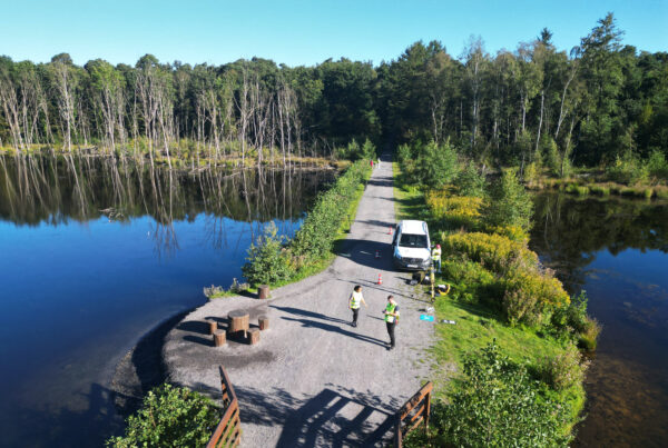
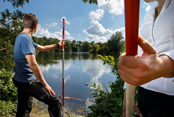
The majority of the NAMIB project now consists of intensive archival work and data research. Methods from mine surveying, i.e., underground surveying, are also being used to document the exact location of the tunnel. The scientists are even evaluating satellite images to detect possible ground movements in the millimeter range. “This is gradually creating a smart map for the entire route and a 3D underground model that we can use to comprehensively represent the post-mining conditions,” says Prof. Rudolph.
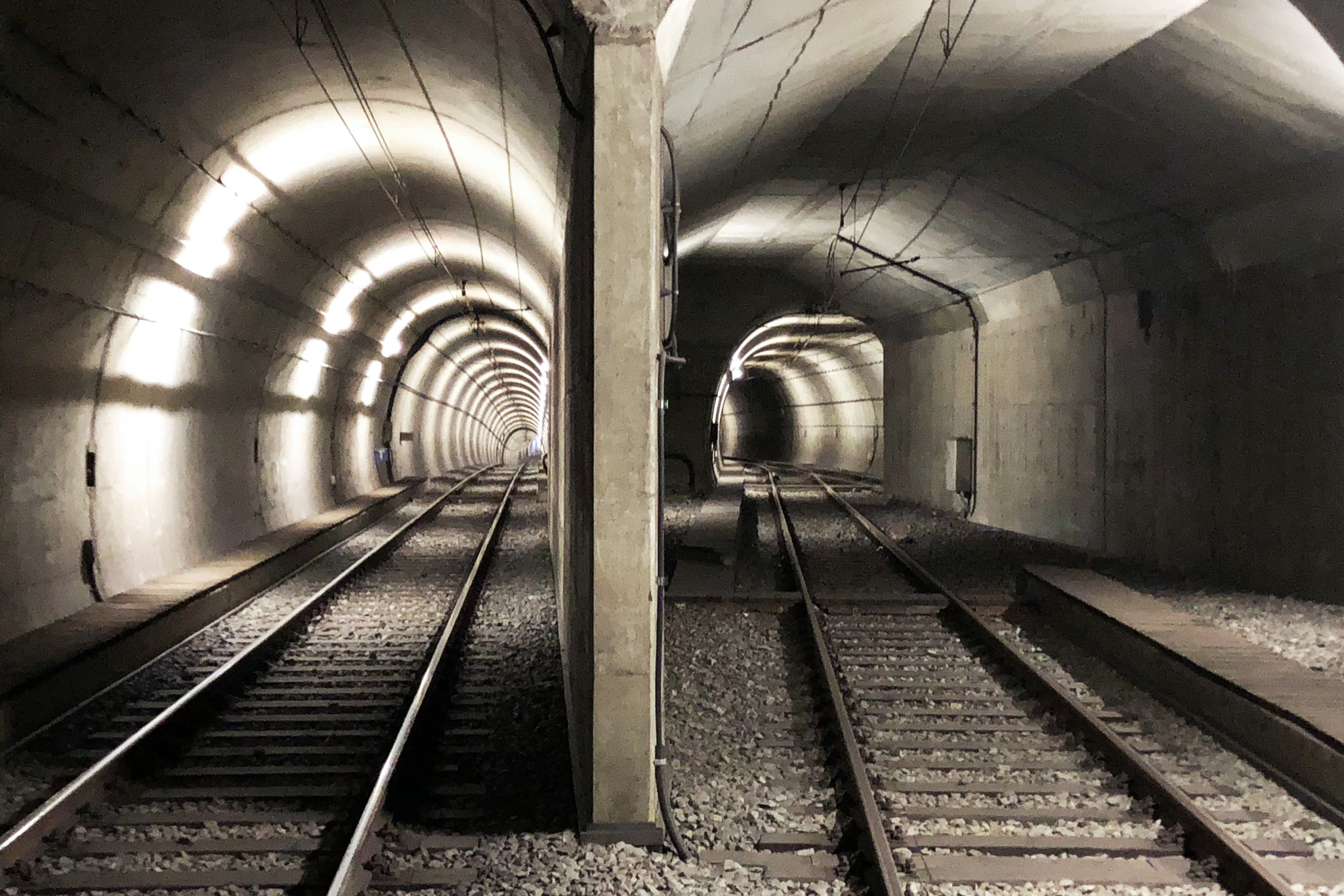
Unusual research area: In the NAMIB research project, subway construction meets post-mining. © Prof. Dr. Tobias Rudolph
Another issue is identifying the potential impact of the planned rise in mine water levels in the Ruhr region. RAG AG's concept envisages allowing the underground mine water to rise very slowly and gradually. This will enable any effects on the surface and the subway tunnels to be determined and observed. In order to develop forecasts for long-term risk management, the researchers at THGA are also taking the time component into account.
In the future, the methods should be used for other urban infrastructure such as buildings, roads, and canals—and possibly in other municipalities, says Prof. Rudolph: “After all, the Ruhr region still offers us a great deal of potential for investigation due to its centuries-old and widespread coal mining industry.”
Contact
Prof. Dr. Tobias Rudolph
Research Center of Post-Mining
Herner Straße 45
44787 Bochum
Building 2, Room 101
Phone 0234 986 3682
Mail tobias.rudolph@thga.de
Prof. Dr.-Ing. Peter Goerke-Mallet
Research Center of Post-Mining
Herner Straße 45
44787 Bochum
Building 2, room 206
Phone 0234 986 3289
Mail peter.goerke-mallet@thga.de