FZN examines old water tunnel in Hattingen using modern methods
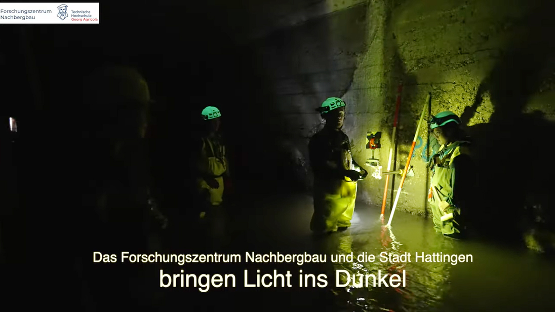
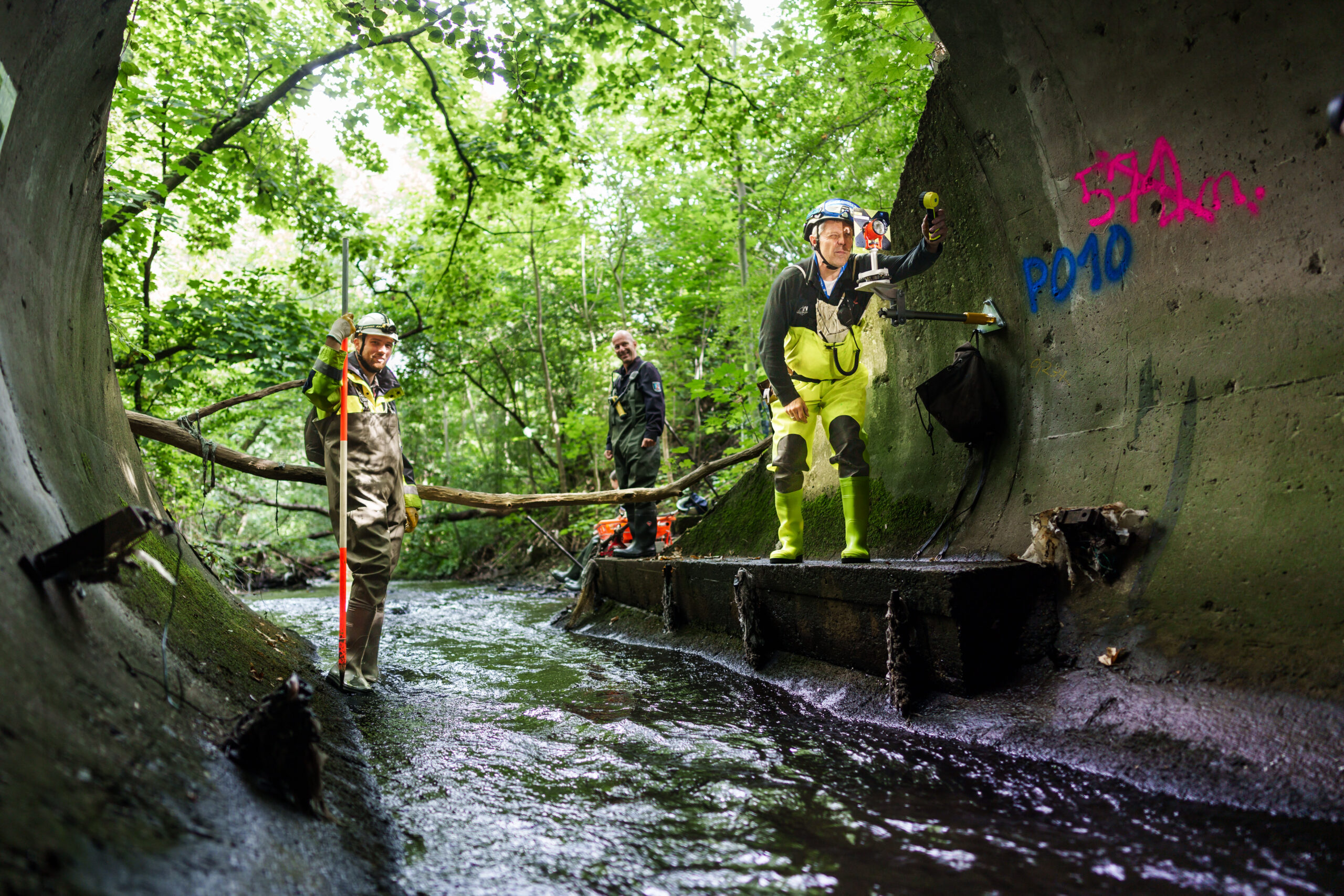
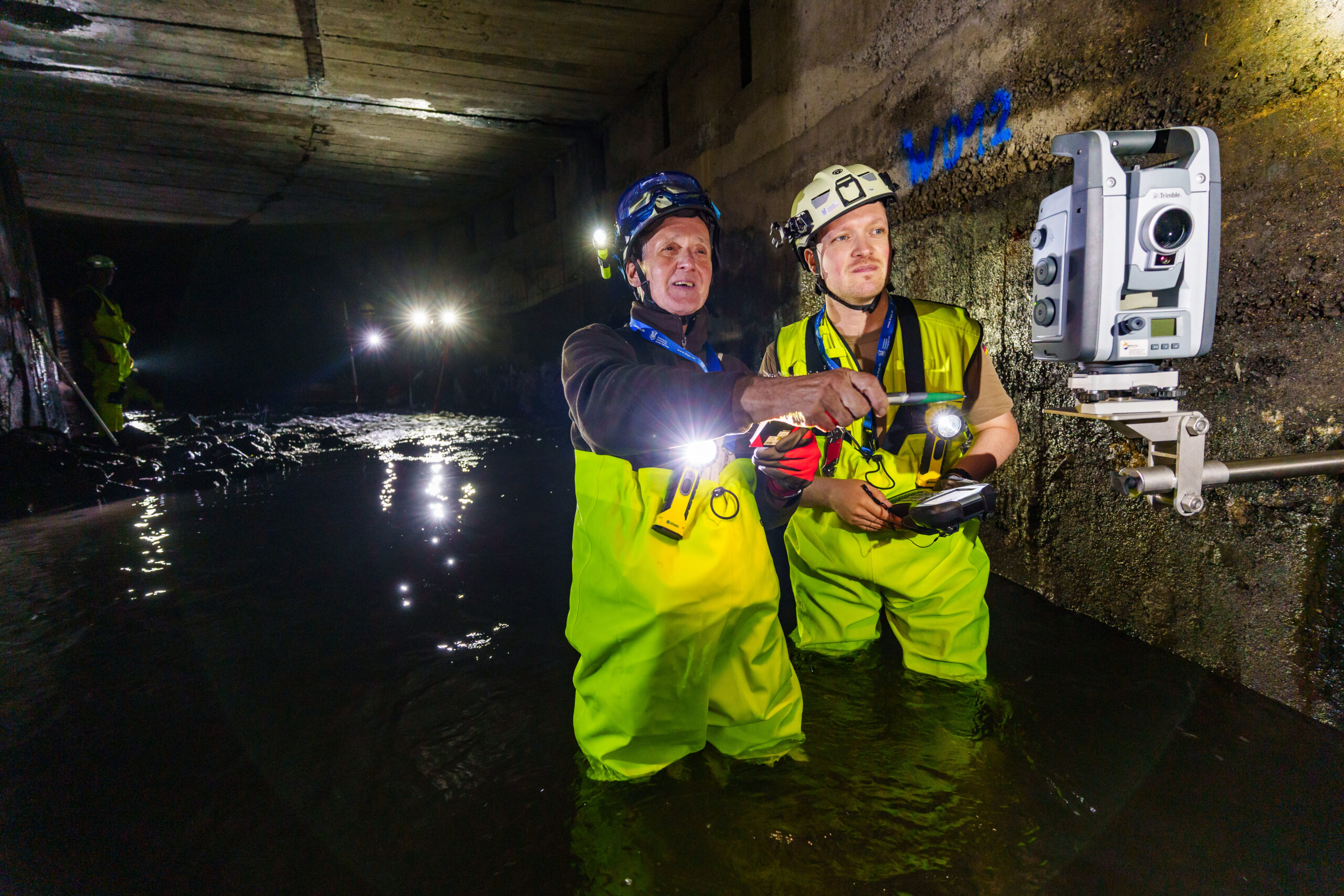
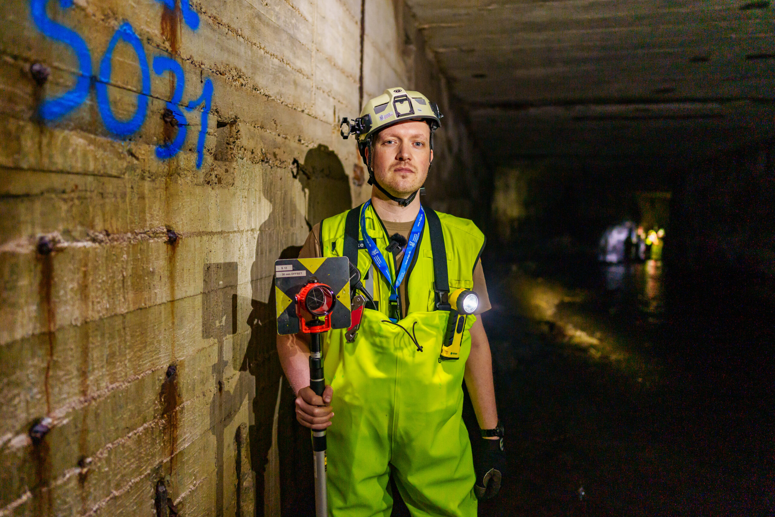
Knee-deep water, winding corridors, a slightly musty smell and absolute darkness. Bats hang on the ceiling. This hidden place is in the middle of Hattingen. Or rather: under Hattingen.
Close to the LWL Museum Henrichshütte, the Paasbach, which until then had flowed freely, suddenly disappears underground. In a wide tunnel, it has been making its way through the underground for more than 140 years. It has rarely been visited so far - but the Research Center for Post-Mining has now investigated it in more detail. In the summer of 2023, the scientific team supported the Hattingen Civil Engineering Office with special inspection work: The aim was to measure the approximately 600-metre-long stretch in detail and identify possible damage. The data obtained provides information about the condition and stability of the road. “Together with the civil engineering office, we developed a plan on how we can best apply our knowledge of geology, mining and modern geomonitoring - i.e. the long-term monitoring of the subsoil - here,” explains graduate surveyor Benjamin Haske from the FZN.
The stream flows into the Ruhr near Hattingen. Before that, it also crosses areas where coal was once mined, for example the structures of the disused Alte Haase colliery. The Paasbach is also influenced by the inflow from historic heritage tunnels. “In its history, the small stream has therefore already experienced many detour and conversions,” explains Melanie Jagusch-Klich from the Hattingen civil engineering office. “In fact, we had to realize that our maps only show the course roughly. We don't have any precise documentation. The details are missing.” But these are important in order to be able to classify the damage accurately.
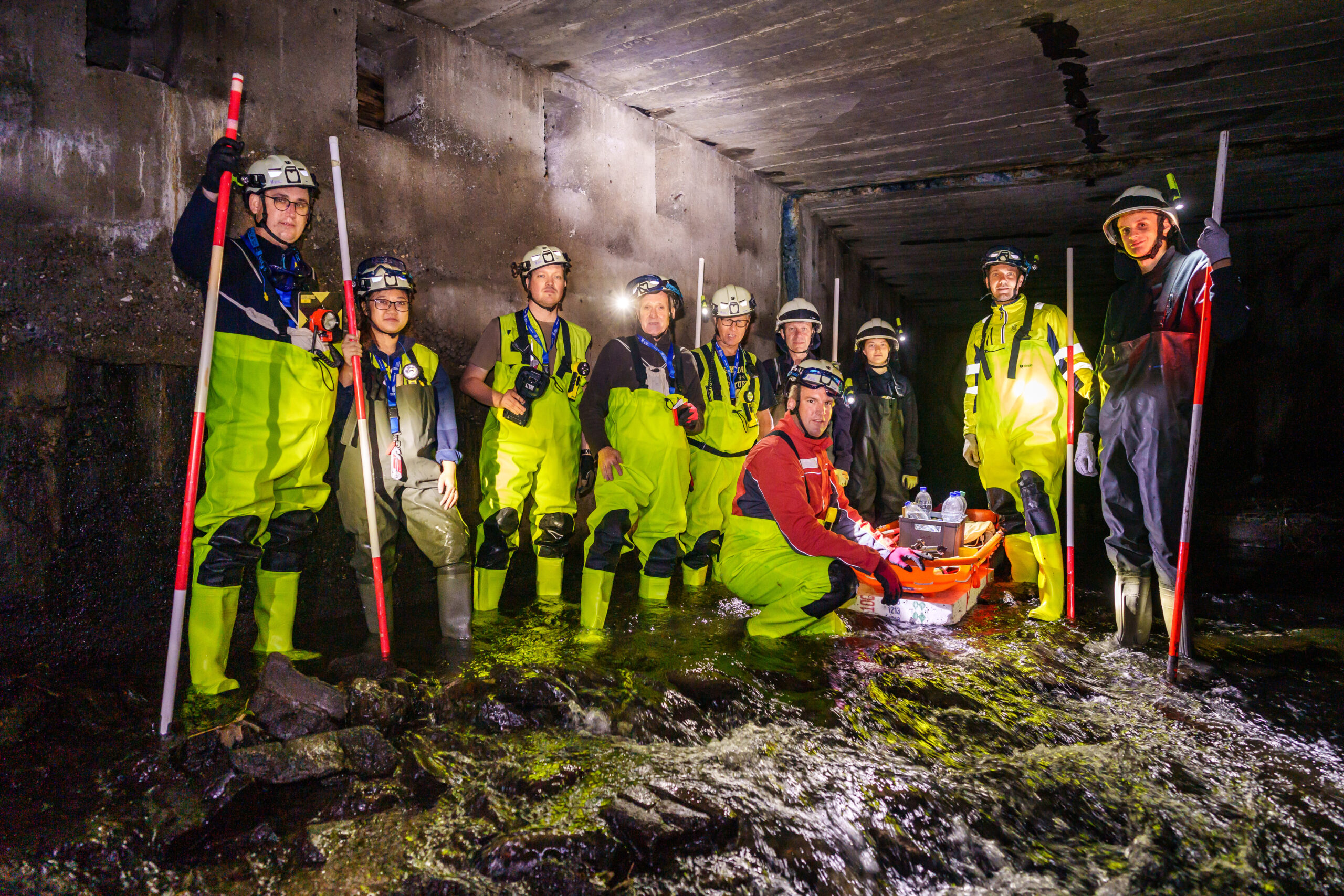
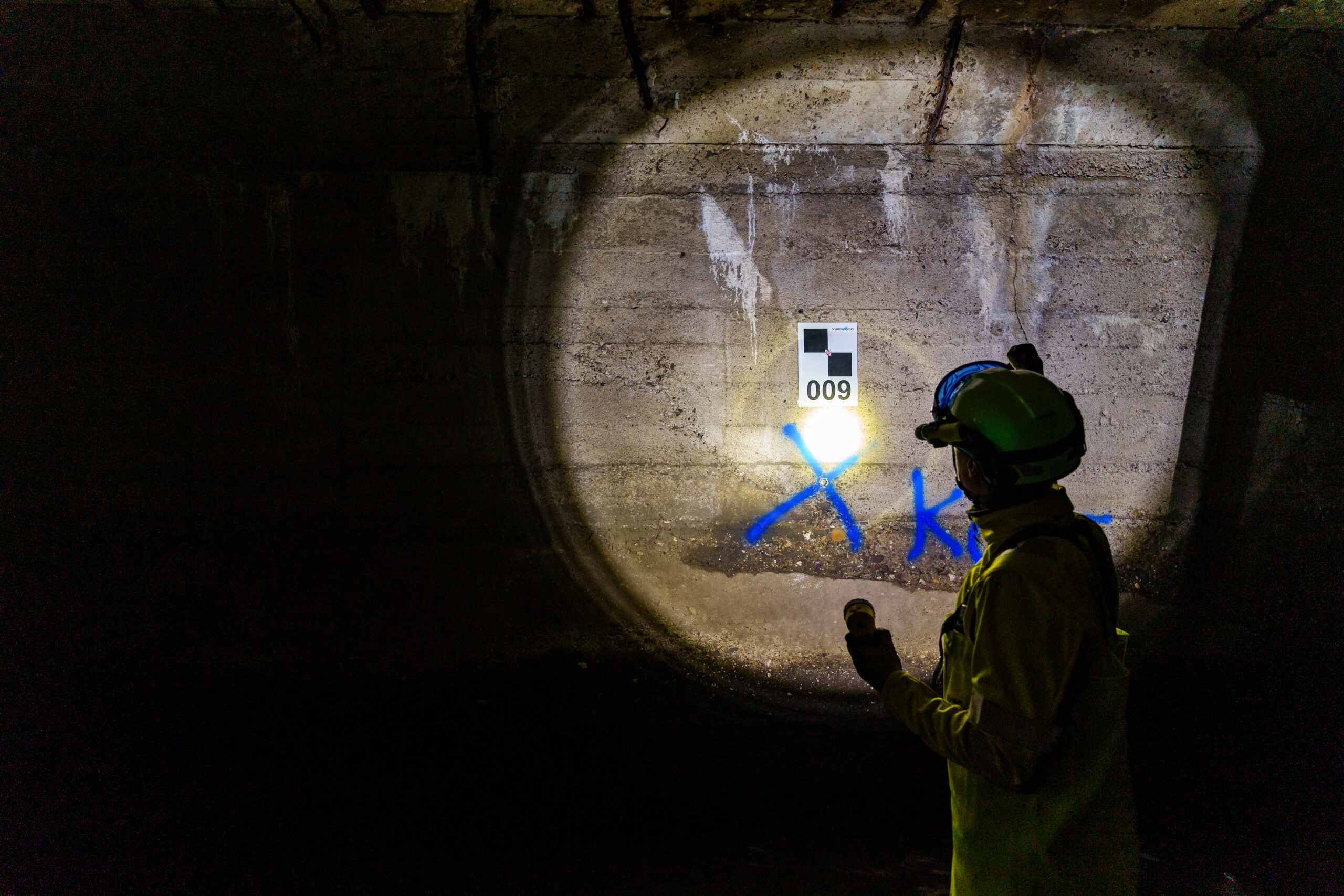
That's why high-tech from Bochum was used: the team from the FZN combined classic measuring methods with modern laser scans in the water tunnel to capture every angle with special sensors. “We manually measured hundreds of individual points, which we used to fit the high-precision 3D model of the laser scan into the correct coordinate system,” explains Benjamin Haske. “However, the special conditions in the tunnel, such as darkness, humidity and cramped conditions, did not make it easy for us and the measuring devices.” Therefore, in addition to the innovative laser scanning technology, traditional methods from mine surveying were also used. “We use all this data to form an overall picture that also takes into account cracks in the concrete or the condition of the various water inlets,” adds his colleague Dr. Bodo Bernsdorf.
As a result, the exact course of the water tunnel was documented for the first time and brought together with modern, topographical maps and an aerial drone image of the surface. The sometimes small distances between the tunnel ceiling and roads and buildings were also recorded for the first time. The interactive 3D model developed enables the experts from the Hattingen civil engineering department to precisely locate material structures and damaged areas in the subsoil. “The results are therefore an important building block for urban risk management,” says Melanie Jagusch-Klich from the Civil Engineering Office. “The comprehensive geomonitoring simplifies future remediation work and helps us to ensure the safety of the above-ground and underground infrastructure.” In this way, this hidden place in Hattingen's underground will be preserved for future generations - and for future bat populations.
Science according to measure: Benjamin Haske studied “Geodesy and Geoinformation” at the University of the Bundeswehr (German Armed Forces) in Munich and then completed a Master's degree in “Geoengineering and Post-Mining” at the THGA. At the FZN, he is responsible for geodata management and conducts research into geodata fusion and analysis, risk management for old mines and the use of drones for geomonitoring.
Video
Sie wollen unsere Forschenden in Aktion sehen? Hier finden Sie unser Video aus dem Untergrund…